Section 5 KCanG · Augsburg
Cannabis no-consumption zones in Augsburg
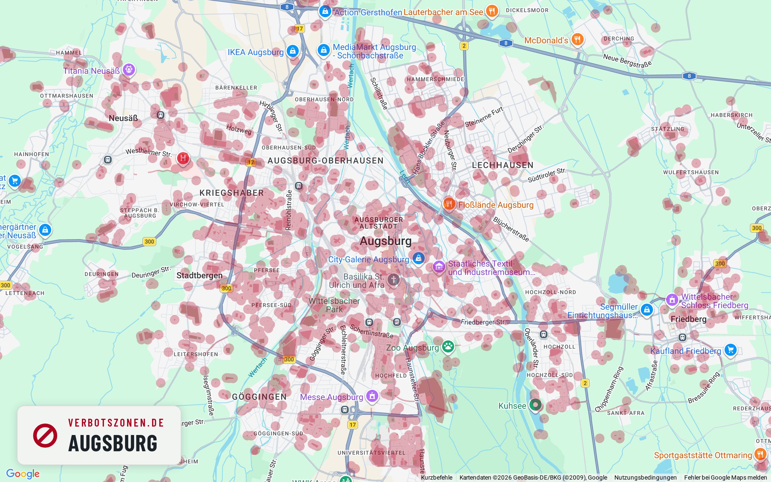
Where can you smoke weed in Augsburg – and where can't you? The map below shows every cannabis no-consumption zone in Augsburg under Section 5 of Germany's Cannabis Act: schools, children's playgrounds, daycare centers, youth facilities and publicly accessible sports grounds, each with the 100-meter radius around its entrance. On top of that, consumption in pedestrian zones is banned between 7 a.m. and 8 p.m.
No-consumption zones in Augsburg on the map

- School
- Kindergarten
- Daycare center
- Playground
- Sports facility
- Other
This map is just the preview – get the full feature set for free in the app.
Well-known places
Well-known places in Augsburg: where can you smoke?
Landmark, park or shopping street: this is how we assess well-known places in Augsburg under § 5 KCanG – each with its own map extract.
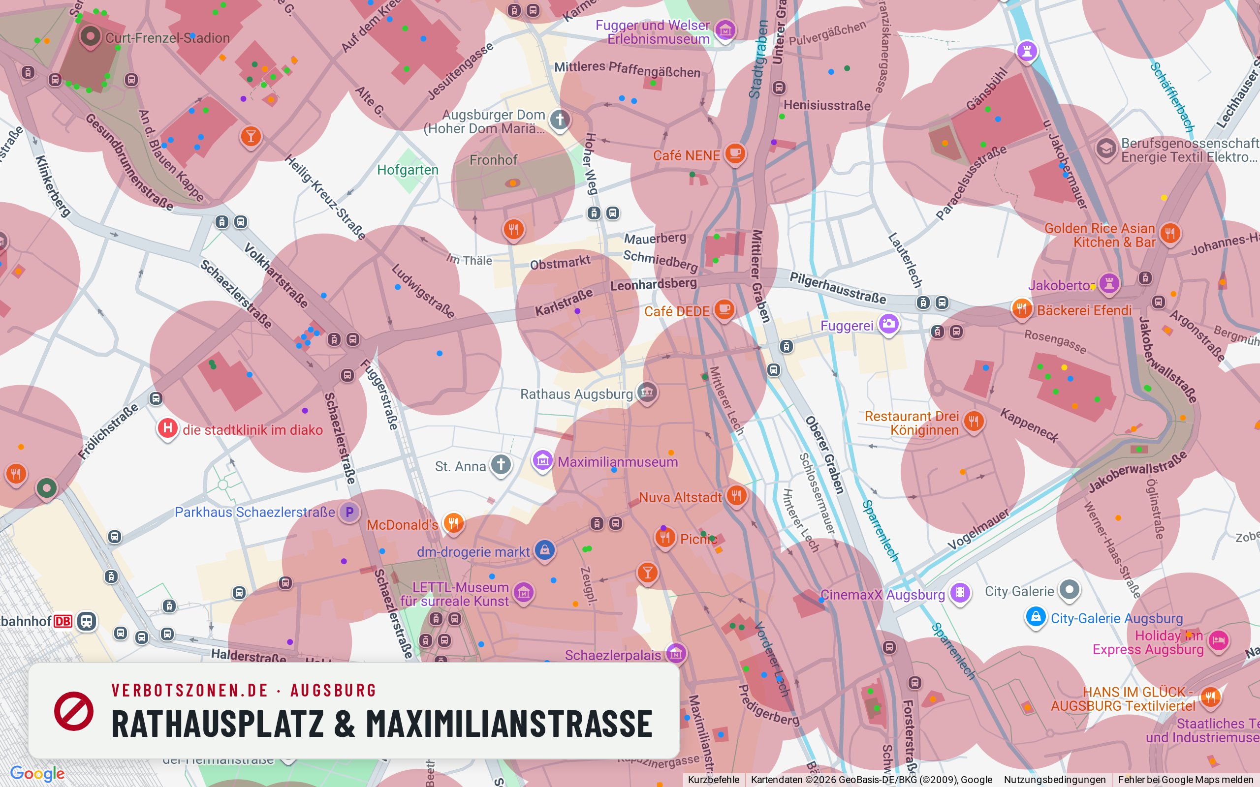
Rathausplatz & Maximilianstraße
The Rathausplatz is a pedestrian area, and our map data puts a playground and a daycare centre about 120 metres away – it is tight here during the day.
Rathausplatz and Maximilianstraße form Augsburg’s grand axis, with the town hall, the Perlach tower and the Renaissance fountains. Our map draws the area as a pedestrian area, so the ban under § 5(2) no. 5 KCanG applies between 7 a.m. and 8 p.m. On top of that the surroundings are unusually dense for a main square: according to our map data, within 300 metres there is a playground at Hunoldsgraben, several daycare centres, sports facilities and other institutions – the nearest about 120 metres away. Their radii apply around the clock, unlike the time window.
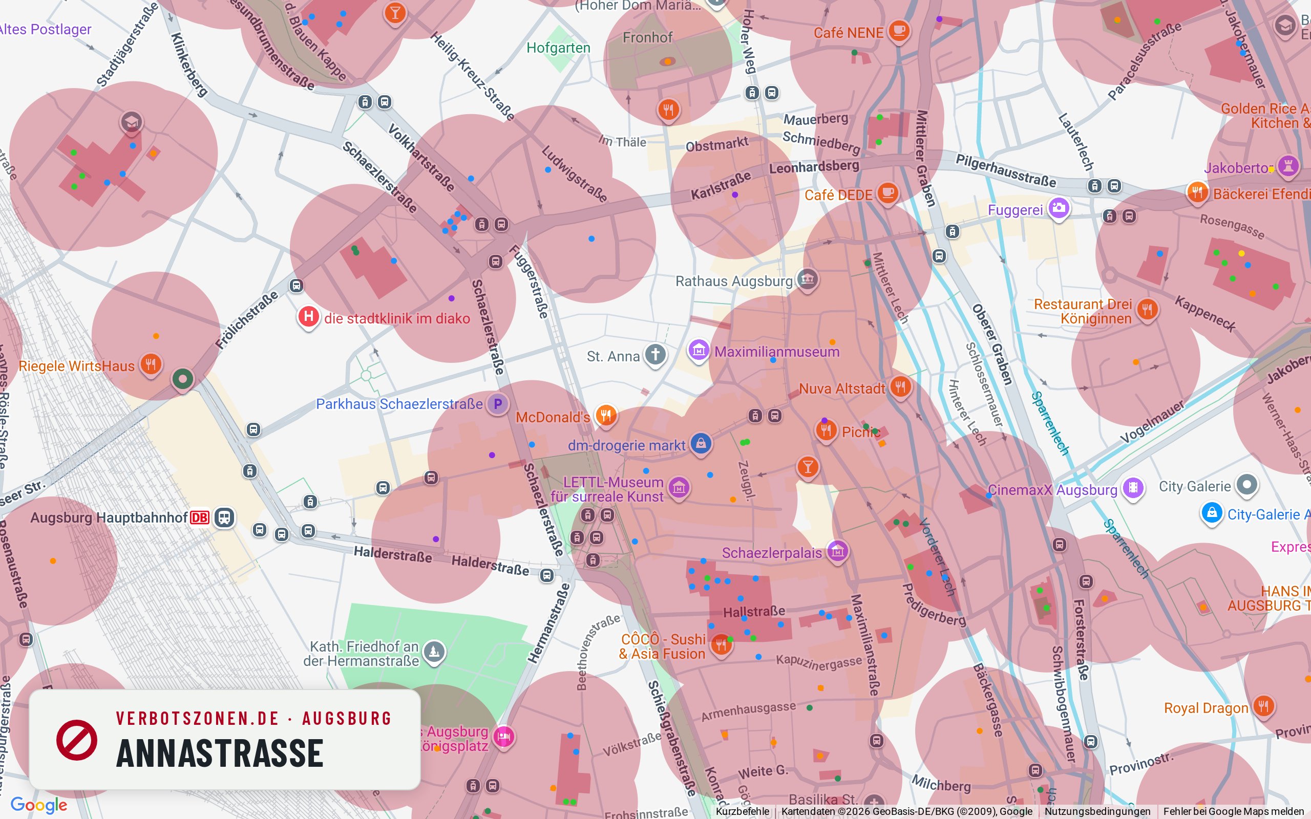
Annastraße
Annastraße is a pedestrian zone, and our map additionally draws an educational institution less than 100 metres away.
Annastraße is Augsburg’s central shopping pedestrian zone, so the 7 a.m.–8 p.m. window under § 5(2) no. 5 KCanG applies to begin with. According to our map data, though, something else comes on top: within 300 metres our data lists more than ten facilities as schools – many of them tutoring, music and language schools, whose classification under § 5 KCanG is not clear-cut in every case. The nearest is about 96 metres away, so its 100-metre radius reaches the street. Anyone who wants certainty should check their exact location on the map.
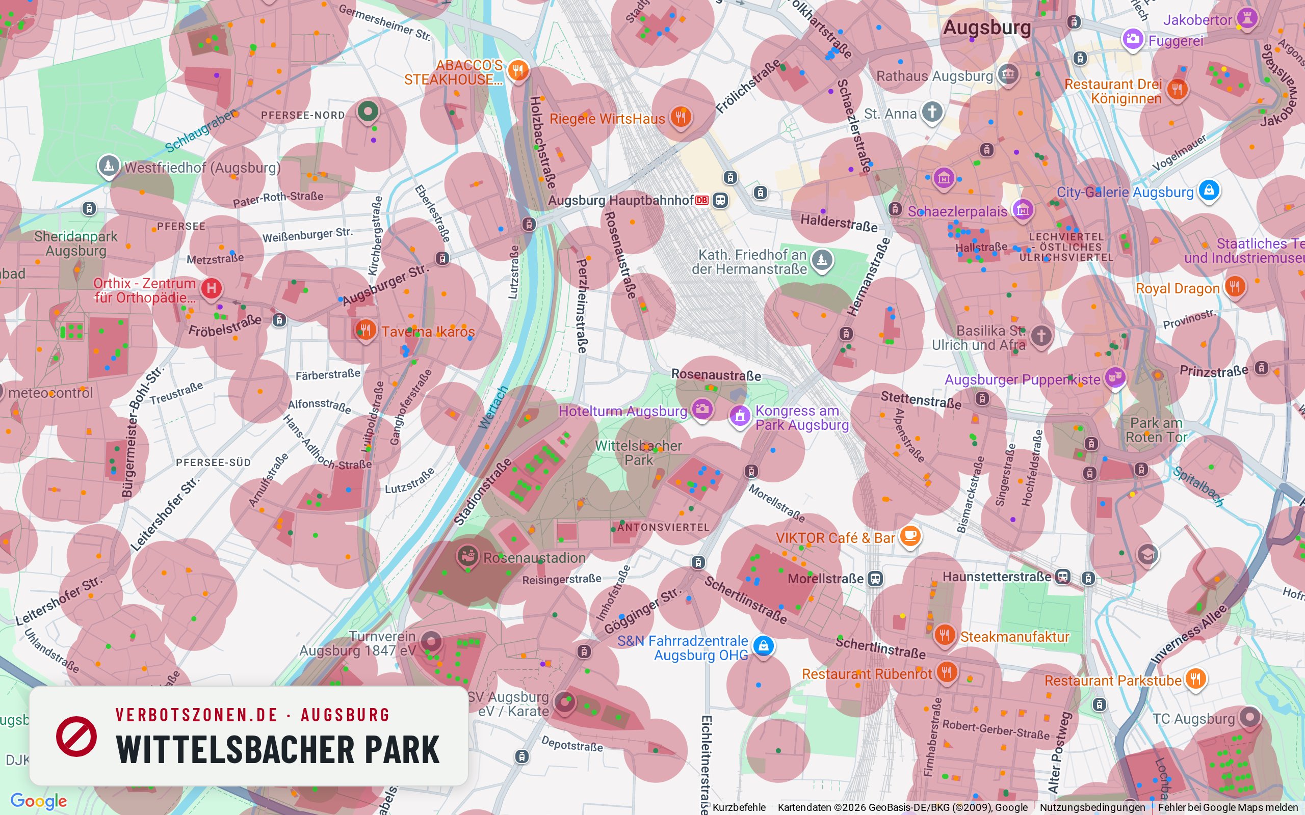
Wittelsbacher Park
According to our map data the Wittelsbacher Park is threaded with playgrounds and sports grounds – the zone-free areas are smaller than they look.
The Wittelsbacher Park around the Kongress am Park is Augsburg’s central green space. Parks are not banned across the board under the KCanG – what matters are the facilities, and there are many here: according to our map data, within 300 metres there are five playgrounds, nine sports areas and several schools, the nearest about 125 metres away. The nearby Rosenaustadion and the grounds on Rosenaustraße contribute further 100-metre radii. Lawns without a drawn zone remain between them, but they are narrower than the park’s open feel suggests.
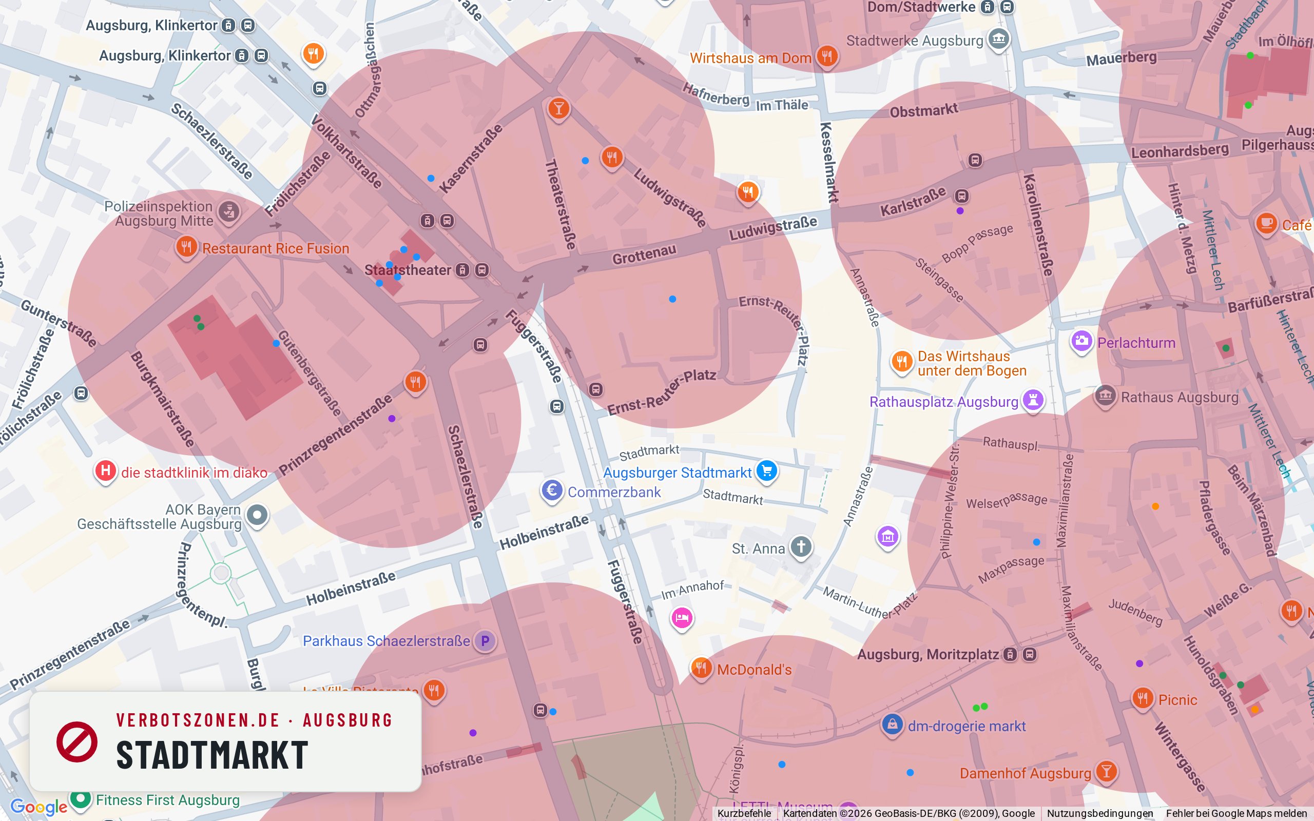
Stadtmarkt
On the Stadtmarkt our map data puts an educational institution’s zone just under 90 metres away – plus the market operator’s house rules.
Augsburg’s Stadtmarkt, with its market halls and the Fleischhalle, is a meeting point well beyond shopping. Two legal layers meet here: on the market grounds the operator’s house rules apply, independently of the KCanG. According to our map data the Leopold-Mozart-Zentrum also lies about 87 metres away, so its 100-metre radius reaches parts of the market; further out come the St.-Anna-Grundschule and several other educational institutions. The surrounding lanes are designated pedestrian areas as well.
All assessments are based on our current map data and can change at any time – new facilities create new no-consumption zones. What counts is the situation on the ground; the live map above and the app always show the current data.
Data sheet
Augsburg's no-consumption zones in numbers
In central Augsburg alone, the Verbotszonen App tracks the following facilities that each carry a no-consumption zone:
- 212School
- 239Kindergarten
- 20Daycare center
- 576Playground
- 828Sports facility
- 32Other
- 1,907facilities in total
Figures cover the inner city of Augsburg (map extent), data source OpenStreetMap. Each facility creates a no-consumption zone with a 100-meter radius around its entrance.
Pedestrian zones
From what time can you smoke in Augsburg? Pedestrian zones and the 7-to-8 rule
In pedestrian zones, cannabis consumption is banned daily between 7 a.m. and 8 p.m. under § 5(2) no. 5 KCanG – from 8 p.m. it is generally permitted there, unless another no-consumption zone applies. What always counts is how the area is designated on the ground. Well-known pedestrian areas in Augsburg include:
- Annastraße
- Bürgermeister-Fischer-Straße
- Steingasse
Common questions
Smoking weed in Augsburg: the rules
Where is cannabis consumption allowed in Augsburg?
Consumption is allowed in Augsburg anywhere no zone under Section 5 KCanG applies: more than 100 meters from the entrances of schools, playgrounds, daycare centers, youth facilities and sports grounds, outside pedestrian zones during the 7 a.m.–8 p.m. ban, and never in the immediate presence of minors. The map shows every zone in Augsburg at a glance.
Can you smoke weed in the Annastraße pedestrian zone?
Annastraße is one of the well-known pedestrian areas in Augsburg. Where a pedestrian zone is designated, the ban under § 5(2) no. 5 KCanG applies daily between 7 a.m. and 8 p.m. – in the evening and at night consumption is generally allowed there, unless another no-consumption zone applies, such as a school or daycare within sight. Whether an individual stretch is actually designated a pedestrian zone can vary; the signage on the ground is what binds.
How many no-consumption zones does Augsburg have?
In central Augsburg alone, the Verbotszonen App tracks 1,907 facilities, each creating a no-consumption zone with a 100-meter radius – including 212 schools and 576 playgrounds. Across the whole city there are considerably more.
Can you smoke weed in the Wittelsbacher Park?
A park is not banned across the board under the KCanG, but according to our map data the Wittelsbacher Park is comparatively tight: within 300 metres our data records five playgrounds, nine sports areas and several schools, each creating a zone with a 100-metre radius around its entrance. Lawns without a drawn zone remain in between. Because many families are about here, the rule on the immediate presence of minors matters as well.
Always with you
The Augsburg no-consumption zones in the app
The map here is only a preview: the free Verbotszonen App shows you live, on the go, which no-consumption zones are near you – in Augsburg and all across Germany.


No-consumption zones in other cities
- No-consumption zones in Berlin
- No-consumption zones in Hamburg
- No-consumption zones in Munich
- No-consumption zones in Cologne
- No-consumption zones in Nuremberg
- No-consumption zones in Stuttgart
- No-consumption zones in Frankfurt
- No-consumption zones in Hanover
- No-consumption zones in Karlsruhe
- No-consumption zones in Dresden
- No-consumption zones in Essen