Section 5 KCanG · Nuremberg
Cannabis no-consumption zones in Nuremberg
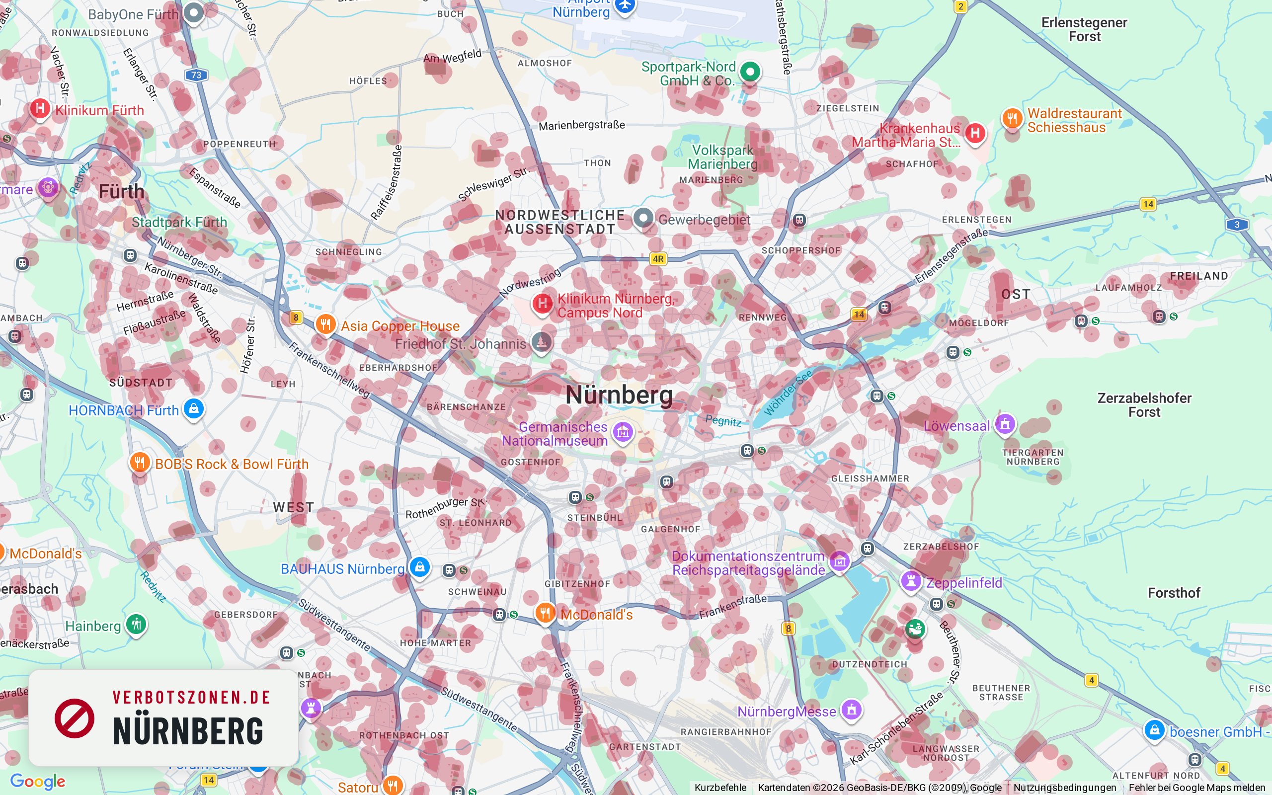
Where can you smoke weed in Nuremberg – and where can't you? The map below shows every cannabis no-consumption zone in Nuremberg under Section 5 of Germany's Cannabis Act: schools, children's playgrounds, daycare centers, youth facilities and publicly accessible sports grounds, each with the 100-meter radius around its entrance. On top of that, consumption in pedestrian zones is banned between 7 a.m. and 8 p.m.
No-consumption zones in Nuremberg on the map

- School
- Kindergarten
- Daycare center
- Playground
- Sports facility
- Other
This map is just the preview – get the full feature set for free in the app.
Well-known places
Well-known places in Nuremberg: where can you smoke?
Landmark, park or shopping street: this is how we assess well-known places in Nuremberg under § 5 KCanG – each with its own map extract.
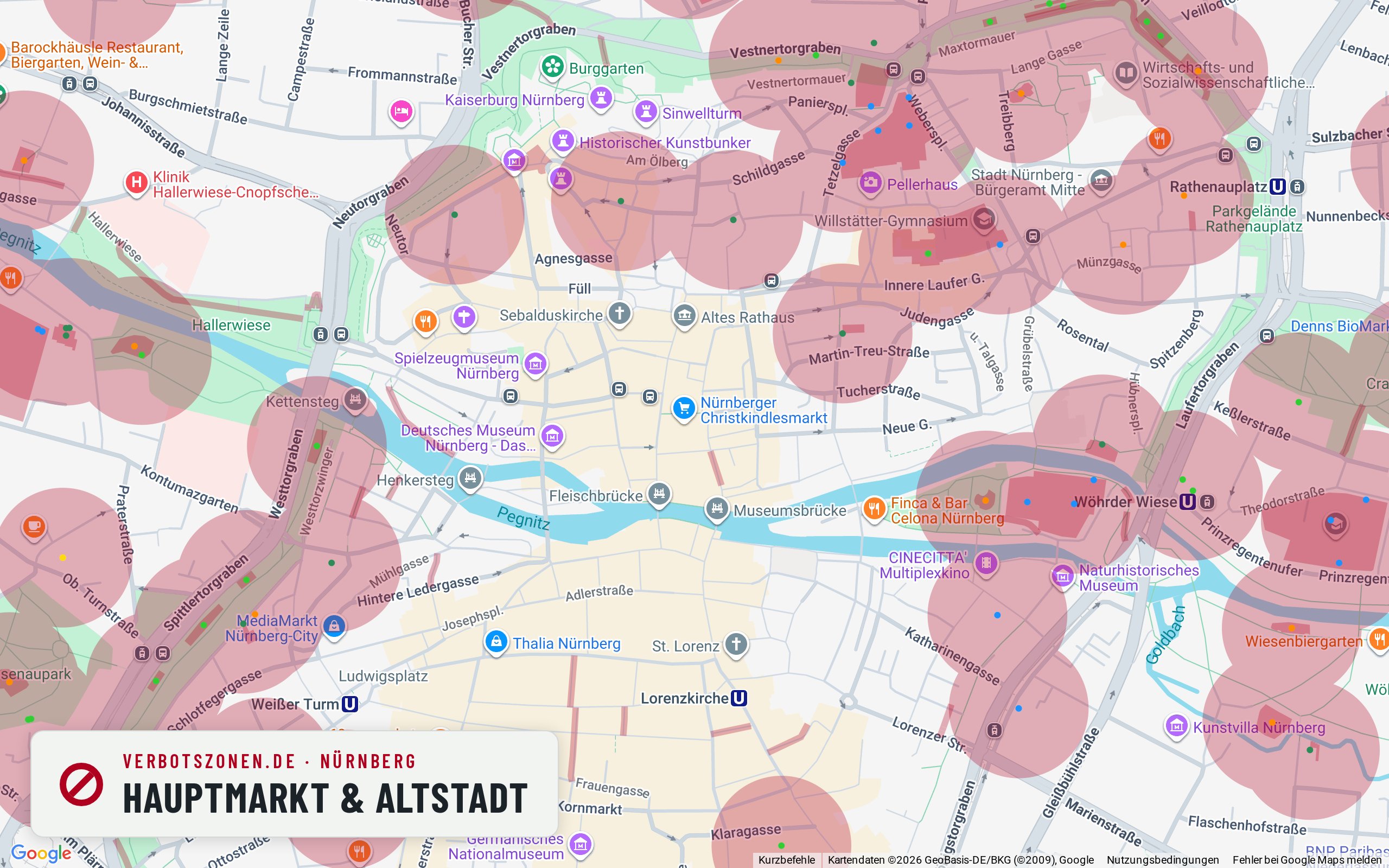
Hauptmarkt & old town
The Hauptmarkt is a pedestrian area – so the 7 a.m.–8 p.m. ban is likely to apply during the day.
The Hauptmarkt with its Schöner Brunnen and Frauenkirche is the heart of Nuremberg’s old town, and our map draws it as a pedestrian area. That brings the 7 a.m.–8 p.m. window under § 5(2) no. 5 KCanG into play – during market hours, and all the more so during the Christkindlesmarkt. Facility zones are sparse here: according to our map data the nearest daycare centre is about 260 metres away. In Bavaria too, enforcement tends to be consistent.
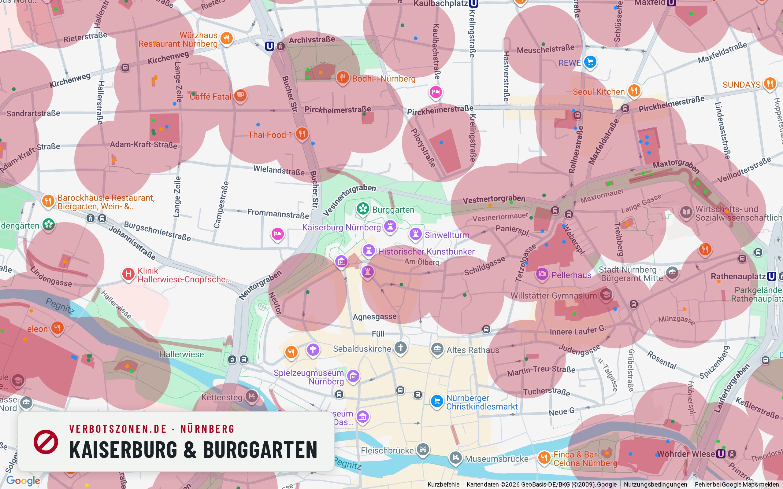
Imperial Castle & castle garden
Around the castle our map draws a crèche a good 100 metres away – so the viewpoint sits close to a zone.
From the Imperial Castle you look out over the whole old town, which is why the walls and the castle garden are popular in the evening. According to our map data a crèche lies about 104 metres from the centre of this extract, two further daycare centres follow at a good 220 and 240 metres, plus a playground and a vocational school. Their 100-metre radii reach into the castle area to differing degrees – so depending on exactly where you stand you may be inside or outside a zone. Some of the approach paths are designated pedestrian areas as well.
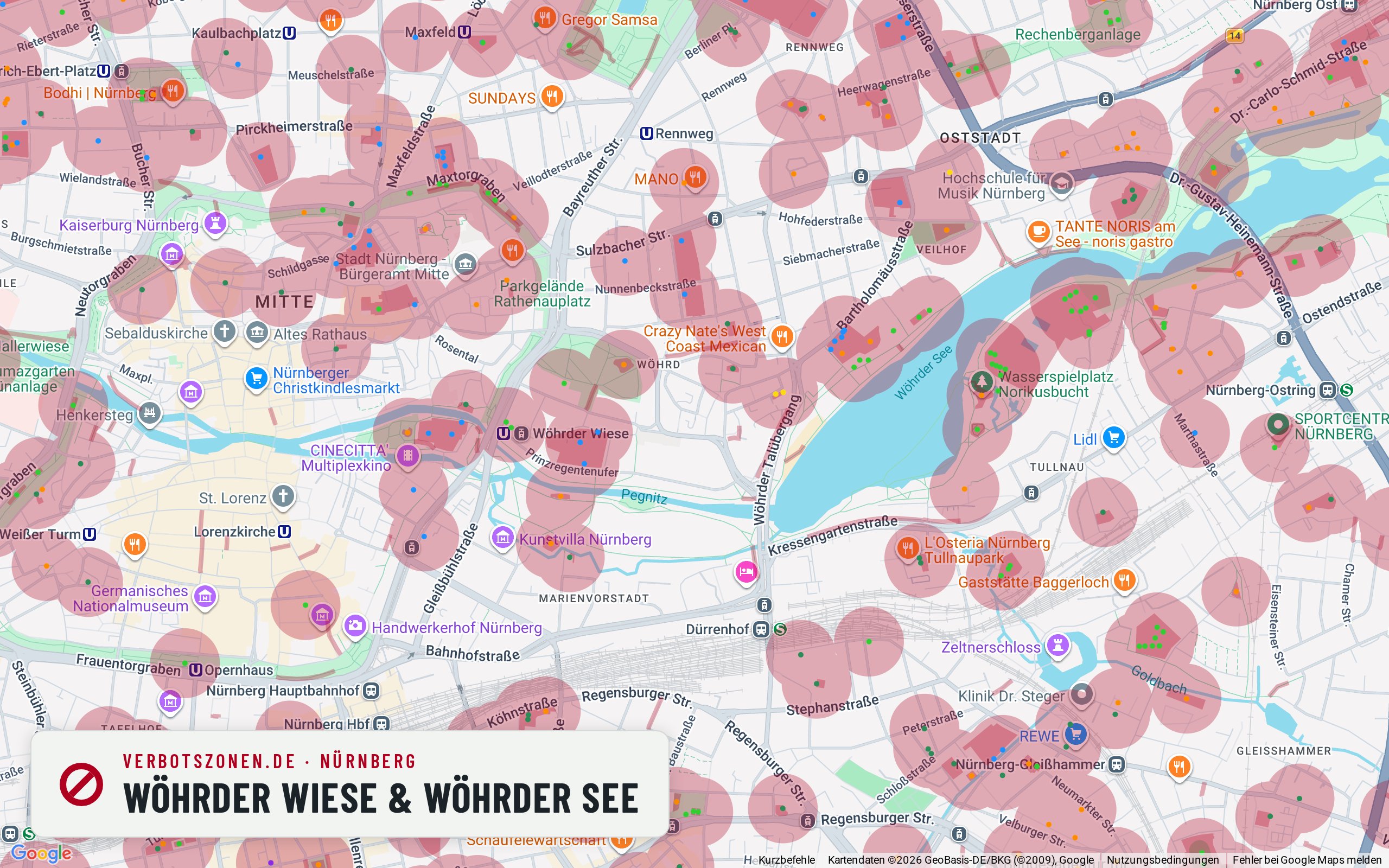
Wöhrder Wiese & Wöhrder See
At the centre of this extract our map draws no zone on the Wöhrder Wiese – daycare centres, a school and a playground sit around the edge.
The Wöhrder Wiese by the lake of the same name is Nuremberg’s local recreation area, with something of a city-beach feel. According to our map data the central lawn stays clear of drawn zones; within 300 metres there is a Protestant kindergarten a good 210 metres off, two further daycare centres, a school and the playground in the Cramer-Klett-Park. Their 100-metre radii mainly catch the edges and access points. On warm days the meadow draws plenty of families, and consuming in the immediate presence of minors is always prohibited.
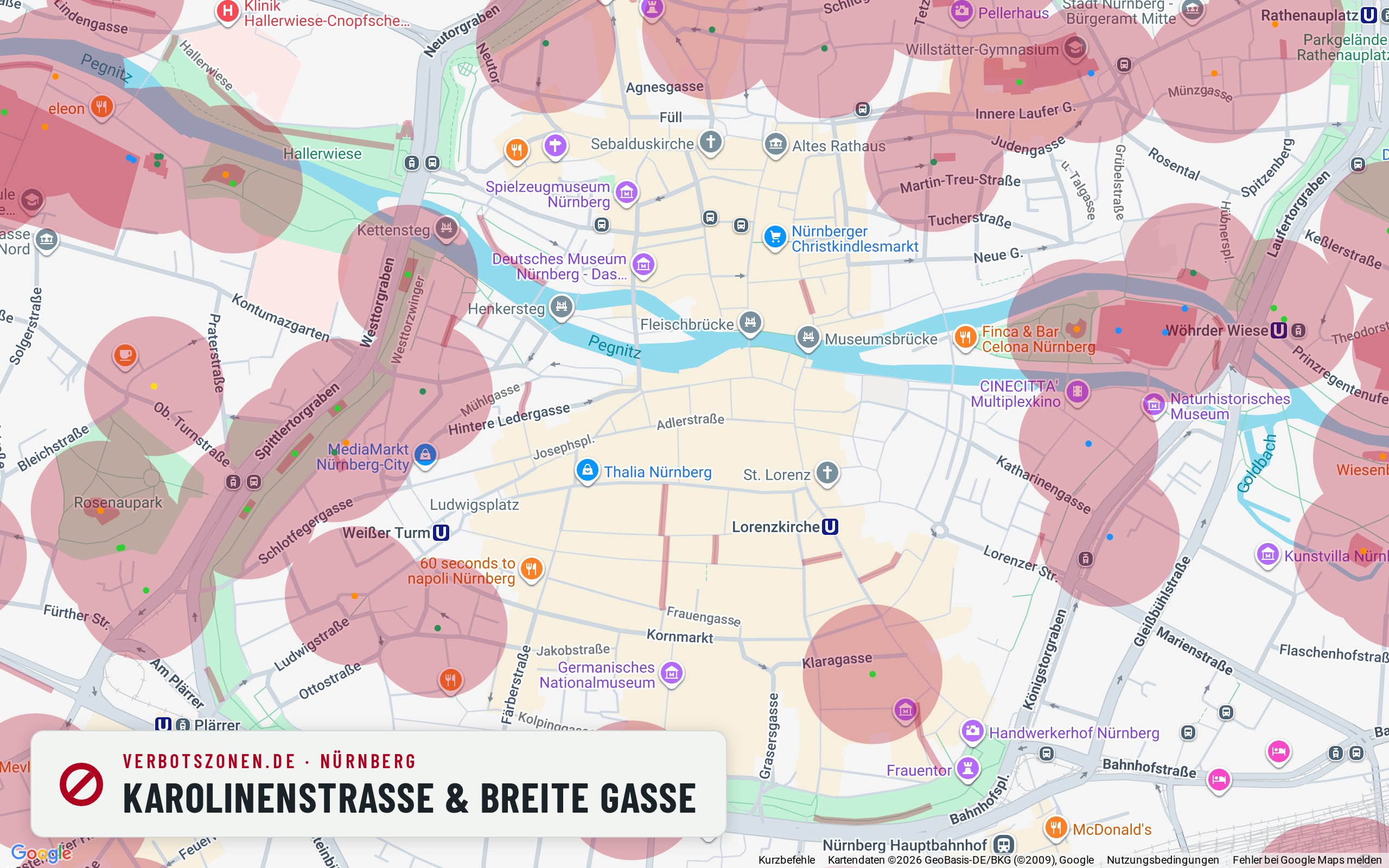
Karolinenstraße & Breite Gasse
Nuremberg’s shopping pedestrian zone: our map data shows no facility zone here – so it comes down almost entirely to the time of day.
Karolinenstraße and Breite Gasse form the old town’s central shopping axis and are drawn as a pedestrian zone. That makes this one of the clearest cases in Nuremberg: according to our map data there is no recorded school, daycare, sports or playground zone within 300 metres, so only the window under § 5(2) no. 5 KCanG applies – banned between 7 a.m. and 8 p.m., generally permitted afterwards. Bear in mind the street stays busy in the evening too.
All assessments are based on our current map data and can change at any time – new facilities create new no-consumption zones. What counts is the situation on the ground; the live map above and the app always show the current data.
Data sheet
Nuremberg's no-consumption zones in numbers
In central Nuremberg alone, the Verbotszonen App tracks the following facilities that each carry a no-consumption zone:
- 209School
- 359Kindergarten
- 10Daycare center
- 347Playground
- 642Sports facility
- 12Other
- 1,579facilities in total
Figures cover the inner city of Nuremberg (map extent), data source OpenStreetMap. Each facility creates a no-consumption zone with a 100-meter radius around its entrance.
Pedestrian zones
From what time can you smoke in Nuremberg? Pedestrian zones and the 7-to-8 rule
In pedestrian zones, cannabis consumption is banned daily between 7 a.m. and 8 p.m. under § 5(2) no. 5 KCanG – from 8 p.m. it is generally permitted there, unless another no-consumption zone applies. What always counts is how the area is designated on the ground. Well-known pedestrian areas in Nuremberg include:
- Karolinenstraße
- Breite Gasse
- Königstraße
- Hefnersplatz / Ludwigsplatz
Common questions
Smoking weed in Nuremberg: the rules
Where is cannabis consumption allowed in Nuremberg?
Consumption is allowed in Nuremberg anywhere no zone under Section 5 KCanG applies: more than 100 meters from the entrances of schools, playgrounds, daycare centers, youth facilities and sports grounds, outside pedestrian zones during the 7 a.m.–8 p.m. ban, and never in the immediate presence of minors. The map shows every zone in Nuremberg at a glance.
Can you smoke weed in the Karolinenstraße pedestrian zone?
Karolinenstraße is one of the well-known pedestrian areas in Nuremberg. Where a pedestrian zone is designated, the ban under § 5(2) no. 5 KCanG applies daily between 7 a.m. and 8 p.m. – in the evening and at night consumption is generally allowed there, unless another no-consumption zone applies, such as a school or daycare within sight. Whether an individual stretch is actually designated a pedestrian zone can vary; the signage on the ground is what binds.
How many no-consumption zones does Nuremberg have?
In central Nuremberg alone, the Verbotszonen App tracks 1,579 facilities, each creating a no-consumption zone with a 100-meter radius – including 209 schools and 347 playgrounds. Across the whole city there are considerably more.
Can you smoke weed at the Wöhrder Wiese?
According to our map data the central parts of the Wöhrder Wiese lie outside any drawn no-consumption zone – a meadow is not banned across the board under the KCanG. The zones come from the facilities around it: several daycare centres, a school and the playground in the Cramer-Klett-Park, each with a 100-metre radius around its entrance, mostly along the edges and access points. On warm days the meadow is a family place, and consuming in the immediate presence of minors is prohibited.
Always with you
The Nuremberg no-consumption zones in the app
The map here is only a preview: the free Verbotszonen App shows you live, on the go, which no-consumption zones are near you – in Nuremberg and all across Germany.


No-consumption zones in other cities
- No-consumption zones in Berlin
- No-consumption zones in Hamburg
- No-consumption zones in Munich
- No-consumption zones in Cologne
- No-consumption zones in Augsburg
- No-consumption zones in Stuttgart
- No-consumption zones in Frankfurt
- No-consumption zones in Hanover
- No-consumption zones in Karlsruhe
- No-consumption zones in Dresden
- No-consumption zones in Essen